

Solutions for Flight Simulation - Solutions for Flight Simulation - Solutions for Flight Simulation - Solutions for Flight Simulation - Solutions for Flight Simulation
|
Latest News : |
||||||||
|
28.08.2004 |
||||||||
|
Navigation go up ... |
||||||||
|
|
Wetzel Technology GmbH is developing digital map applications for the use in development, engineering and training simulators. Overlays allow to display an unlimited number of symbols like waypoints, routes, tactical overlays, navigation overlays etc. The pixmap data for map representation can be loaded by the user. A graphical user interface allows the easy asssignment of Map-pixel coordinates to Lat/Long coordinates.
Additionally, a ARINC 424 reader allows to display different navigation charts.

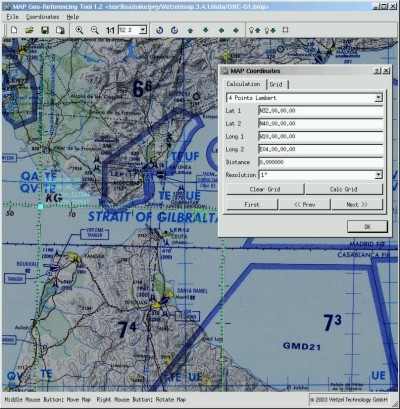
Map Geo Referencing
 |
Load any Raster map into GeoRef Tool | |
|
Reference Lat/Long Grid | |
|
Scissor map | |
|
Export map tiles |
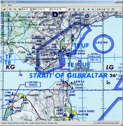
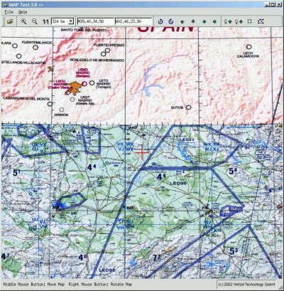
Test Map with map tool
|
Load map tiles exported by GeoRef Tool | |
|
Test map |
Integrate Map into application
|
Easy integration in own applications | |
|
Use of different maps at the same time | |
|
Unlimited size | |
|
intelligent cache management of loaded maps |
Different layers
|
Use different layers for displaying different map scales |
Available Platforms:
|
Linux x86 | |
|
Windows 2000/XP | |
|
Irix |
|
© Wetzel Technology GmbH |
|
|
|
|
Hermann-Oberth-Str.9 |
|